
A Brief History of Hocking Hills State Park
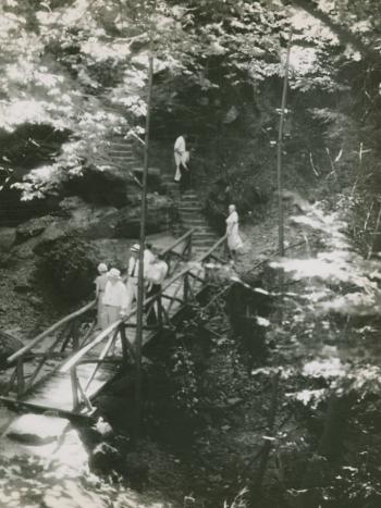
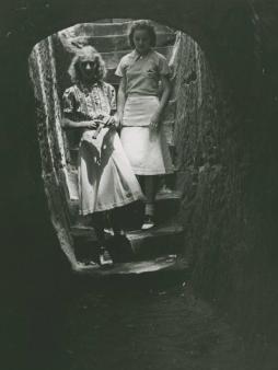
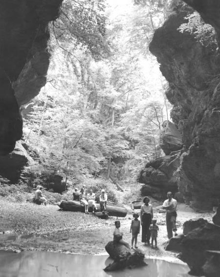
Saturday, June 4, marks the American Hiking Society’s annual National Trails Day, a day to enjoy some of America’s great trails. Ohio Memory is celebrating National Trails Day by guiding you through a brief tour of Hocking Hills State Park, highlighting some of the spectacular geological features and rich history surrounding the area. This post features several photographs from Ohio Memory, showing visitors enjoying the caves, trails, and wildlife of Hocking Hills in the 1930s.
Part of Wayne National Forest, Hocking Hills State Park is located in Hocking County in southern Ohio. The land which comprises Hocking Hills Park is part of the Allegheny Plateau, a large plateau spanning from central New York to the north, through Pennsylvania and eastern Ohio, to West Virginia to the south. Over 330 million years ago, the Hocking Hills region was covered by the Atlantic Ocean, depositing the sand and gravel which eventually formed the Blackhand sandstone the area is known for, named after a black hand print petroglyph left by American Indians on a cliff face near what is now Newark, Ohio.
After a time the ocean receded, and millions of years of erosion from streams and groundwater cut through the soft middle layer of sandstone, resulting in the iconic rock formations and natural features the region is known for today. The residual moist climate allows many tree and plant species which require damp environments to grow in this region, such as hemlocks and Canadian yews, which are otherwise not found in Ohio.
Although Americans flood the park every year, the Hocking Hills region has a long history of settlement and people utilizing its copious resources. Shawnee, Delaware and Wyandot tribes frequently hunted and lived in this region in the 1600s and 1700s, although archaeological evidence documents that American Indian peoples inhabited the area as early as seven thousand years ago. These American Indian tribes referred to the Hocking River as the Hockhocking, or the bottle neck river, because of the bottle shape of the river gorge. The Northwest Ordinance of 1787 and the Treaty of Greeneville in 1795 allowed pioneers to settle the area in the late 1790s. Hocking later became a county in 1818 and settlement expanded with the completion of the Hocking Canal in 1840. The region and its inhabitants contributed to Ohio’s role in the Civil War by using locally extracted iron to manufacture ammunition and cannons for the Union Army.
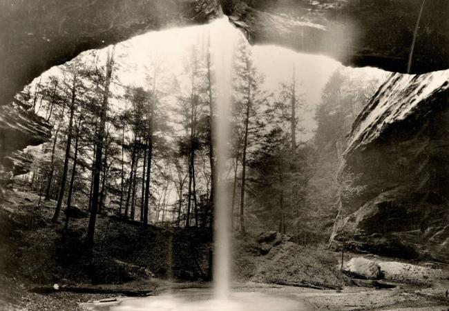
Old Man’s Cave, perhaps the most famous and visited area of Hocking Hills State Park, received its name from 19th century hermit Richard Rowe, who is said to have lived in the cave in his old age after migrating to Ohio from the Cumberland Mountains of Tennessee with his family. Rowe is supposedly buried in the cave, and locals coined the name “Old Man’s Cave.”
The rock formations and park became a popular destination in the late 1860s, and in the early 1900s these areas became more accessible to visitors. In 1924, the State of Ohio purchased 146 acres of Hocking County which became the first installment of the future state park. In the early 1970s, the park built a dining hall and log cabins, which further increased visitor numbers. Today, people from all over the state and beyond journey to the Hocking Hills to enjoy the caves, waterfalls, cliffs, and beautiful wildlife in the park.
Whether you’re looking to cool off in Old Man’s Cave, or experience the grandeur of Cedar Falls, a trip to Hocking Hills State Park never disappoints. In honor of National Trails Day, spend a day at one of Ohio’s many Metro or State Parks, and spend a little time with Ohio’s history while you’re at it!
For more information about Hocking Hills State Park, National Trails Day or parks in your area, visit these online resources:
Ohio Department of Natural Resources
Thanks to Kristen Newby, metadata coordinator at the Ohio History Connection, for this week’s post!


Leave a Reply
You must be logged in to post a comment.