
Give Me Land, Lots of Land
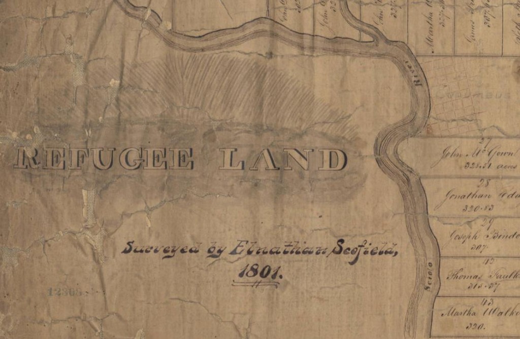
Through the center of Ohio, in parts of Franklin, Licking, Fairfield and Perry counties, lies the Refugee Land Grant tract. Measuring over 100,000 acres, this large section of land was originally set aside for Canadian refugees who, in support of the American Revolution, had fled their native country rather than live under British rule. Specifically, the restrictive terms of the grants stated that grant recipients must have left Canada and supported the Revolution for its entire duration. As a result, not many individuals qualified for land under these terms. A number of former Canadians did qualify, however, and in 1801 a Congressional act established the boundaries of the tract.
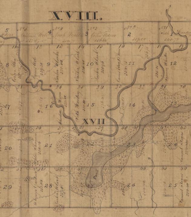
That same year, Connecticut resident Elnathan Scofield surveyed the tract, including a list of 67 grantees. Perhaps as a result of his time surveying the tract, Scofield relocated to Ohio the following year, settling in Lancaster. According to a brief biological sketch included on the finding aid for his papers, which are now held by the American Antiquarian Society, Scofield’s careers were varied; aside from his work as a surveyor, he was a County Surveyor, a Justice of the Peace, a postmaster for Lancaster County, a commissioner of the Bank of Chillicothe, a judge for the Court of Common Pleas in Fairfield County, and also ran a dry goods store, and was elected to both branches of the Ohio legislature. Scofield died in 1841 and is buried in Grandview Cemetery in Bremen, Fairfield County, Ohio.

Scofield’s map of the Refugee Land Grant tract, now backed by fabric for stability, is nearly two feet tall and well over five feet long. It resides in the Rare Book Room at the State Library of Ohio but has recently been digitized for easier access. It is a remarkable record of a period before Ohio became a state, and we are thrilled to share it with visitors to Ohio Memory.
If you would like to learn more about the Refugee Land Grant tract, the Auditor of the State of Ohio has published a document, The Official Ohio Lands Book, which provides a history of Ohio’s lands and its occupants. Incidentally, the Refugee Land Grant tract continues its significance today; the Ohio Statehouse and many of Columbus’s downtown buildings now stand on the tract, which is bordered roughly by 5th Street on the north and Refugee Road on the south. The next time you visit Columbus, perhaps this knowledge of its history will enhance that visit a bit!
Thank you to Shannon Kupfer, Digital/Tangible Media Cataloger at theState Library of Ohio, for this week’s post!


Leave a Reply
You must be logged in to post a comment.