
Maps & Timelines
Want to explore the great state of Ohio through both space and time? View our collection of interactive maps and timelines below!
Then and Now Maps
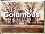
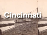
Take a look at downtown Columbus, Cincinnati and Cleveland from the perspectives of the past and present! Simply click on the city you’d like to explore, and once the map renders, click on any of the map markers to see a “Then and Now” view of the location using historical Ohio Memory images and current Google Street View.
 |  |  |
Timelines
Timelines are an exciting and dynamic way to look at important events and periods in Ohio’s history. Featuring images from the digital collections on Ohio Memory, they allow you to navigate through a visual representation of the turning points that helped make the state we know today!
 | Ohio’s Founding and Early Statehood | Learn about the early years of Ohio’s history, from the Northwest Ordinance in 1787 through the first years of statehood after its founding in 1803. |
 | Severe Weather in Ohio | Learn about more than 25 of the most extreme or most unusual weather events from Ohio’s history, from mysterious tidal waves and tornadoes causing local devastation and snowstorms to floods with statewide impact. This timeline is based on the Severe Weather in Ohio online exhibit created in 2006 in collaboration with numerous institutions across the state. |
 | The War of 1812 | Explore major events, battles and turning points of the War of 1812, a conflict between the United States and Great Britain that had a lasting impact on Ohio. |
Have a site or location that you’d like to see included in our Then and Now maps, or an idea for a Timeline topic for us to illustrate? Contact us at [email protected]!