
Connecting the State and the Nation: Ohio Canal History
When Ohio became a state in 1803, it was part of the American frontier, separated from the East Coast by mountains that made trade and travel difficult and expensive. The only way to move goods and people overland involved roads that were sometimes impassable after heavy rains or snow. Although the federally funded National Road reached Wheeling, West Virginia, by 1818, it wouldn’t reach central Ohio until the 1830s. In the meantime, Ohio turned to canals.
In 1822, the Ohio General Assembly created an Ohio Canal Commission and hired James Geddes, an engineer who had worked on New York’s Erie Canal, to determine the best route for connecting Lake Erie and the Ohio River. The Canal Commission eventually recommended two routes, one eastern (the Ohio & Erie Canal) and one western (the Miami & Erie Canal), each of which included smaller feeder canals. The legislature approved both routes in 1825, and on July 4 of that year, Ohio Governor Jeremiah Morrow and New York Governor De Witt Clinton dug ceremonial shovelfuls of soil from what would become the Ohio & Erie Canal. Work started on the Miami & Erie Canal that same month. Although the total cost of the canal system came close to bankrupting the state government, the canals helped Ohio citizens prosper for the next three decades.
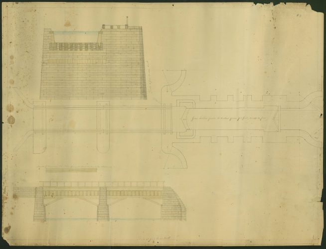
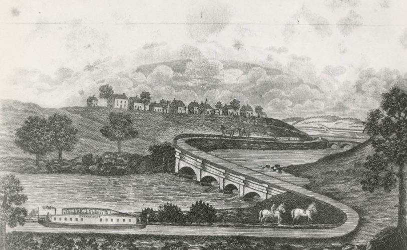
The Ohio & Erie Canal was completed in 1833, and the Miami & Erie Canal was completed twelve years later. On average, the canals were at least forty feet wide at the water line and narrower at the bottom, with a water depth of four feet—all excavated by hand using picks and shovels. At the peak of construction, more than 4,000 workers (mostly Irish and German immigrants) dug trenches, lined them with sandstone, and constructed locks for approximately thirty cents per day plus room and board. Several Ohio communities, including Akron, began as towns for the canal workers.
When completed, the Ohio & Erie Canal stretched more than 300 miles through nearly 150 lift locks and connected the cities of Cleveland and Portsmouth. The Miami & Erie Canal covered more than 270 miles from Toledo to Cincinnati. The entire system, including main and feeder canals, was roughly 1,000 miles.
Maintaining the canals wasn’t easy; flooding could damage locks, walls, and towpaths, as could freezing. To avoid this, canals in the northern part of the state were usually drained during the winter months. But the benefits were worth the work. The canal could provide travel from Cleveland to Portsmouth in roughly eighty hours (a trip that once would have taken weeks). Information from New York that took thirty days to arrive before the canals now took only ten days. The cost to ship goods to and from the East Coast dropped from $125/ton by horse and wagon to $25/ton by canal, which spurred economic growth and decreased East Coast reliance on expensive European imports. Cleveland became an industrial and commercial center with access to major East Coast cities via New York’s Erie Canal. The Ohio & Erie Canal’s connection to the Ohio River (and therefore the Mississippi River) opened access to the nation’s expanding frontier and helped tie those areas into a growing nationwide economy.
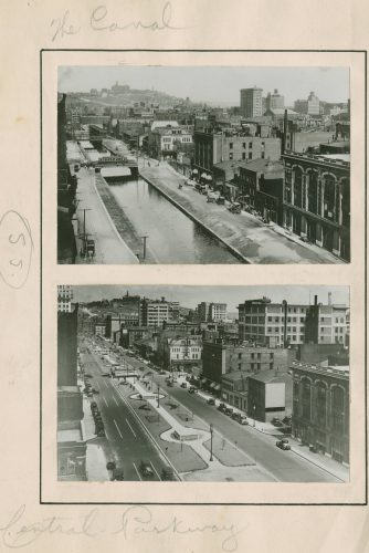
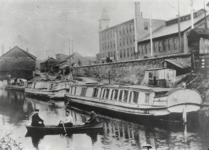
However, Ohioans without canal access began advocating for railroads as early as the 1820s. By the 1850s, railroads were becoming the favored mode of transportation. Although shipping by rail was more expensive than shipping by canal, railroads were much faster and weren’t dependent on a water source. Despite this shift, the canal system still functioned until massive flooding in the spring of 1913 destroyed multiple banks and locks, ending statewide canal travel.
The 1960s and 1970s brought renewed interest in preserving or repurposing the remaining sections of Ohio canals. Portions of the Ohio & Erie Canal are now managed by the National Park Service as part of the Cuyahoga Valley National Park. Other federal and local initiatives have preserved portions of Ohio canals for canoeing and bike trails. In several Ohio locations, including Ohio History Connection’s Johnston Farm and Indian Agency, visitors can experience history firsthand by riding replica canal boats on restored portions of the original Ohio canals.
Thank you to Stephanie Michaels, Research and Catalog Services Librarian at the State Library of Ohio, for this week’s post!

Leave a Reply
You must be logged in to post a comment.